
Preparing for Worst-Case Scenarios
Civil Engineering Computational Hydroscience and Engineering Earthquakes Efficient Evacuation Faster Response Flood Damage Flood Warning Systems Helping Responders Hurricanes Improved Dam Designs Improved Levees Infrasonic Listening Stations Natural Disasters Soil Erosion Sound Waves Water Flow Simulation The University of Mississippi

In recent years, the worst has happened.
A tsunami devastated Southeast Asia. Hurricanes and cyclones have swept over the Gulf Coast of the United States and the river deltas of Myanmar, with terrible losses of life and infrastructure. Major earthquakes have rocked China and Pakistan.
About the only thing predictable about natural disasters is that they will happen. The best humans can do is prepare for them. For that, the world has help from University of Mississippi researchers.
A Better Flow
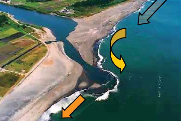
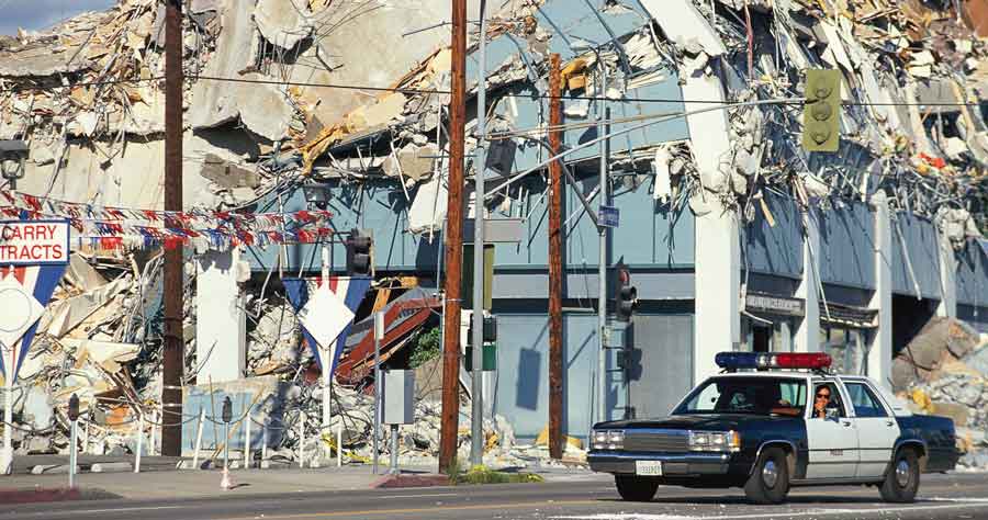
Though Hurricane Katrina’s surge was powerful, the majority of people killed in the terrible storm died a day later, after levees broke around the city and water poured through the breach, flooding entire neighborhoods.
At the National Center for Computational Hydroscience and Engineering (NCCHE), the research team is known worldwide for its ability to not merely estimate but actually simulate water flows, sediment and pollutant transport, soil erosion and flood damage with a highly complex, constantly improving computational model.
The Department of Homeland Security trusts NCCHE to help them predict how, where and why dams or levees break—and then, crucially, what happens next.
Dr. Sam Wang, a Barnard Distinguished Professor, has won distinguished honors (Hans Albert Einstein Award from the American Society of Civil Engineers, 2003; Qian Lin Award from the World Association for Sedimentation and Erosion Research, 2007) for his achievements modeling free surface flow, erosion and sedimentation processes. He founded NCCHE in 1983 and has been its director ever since.
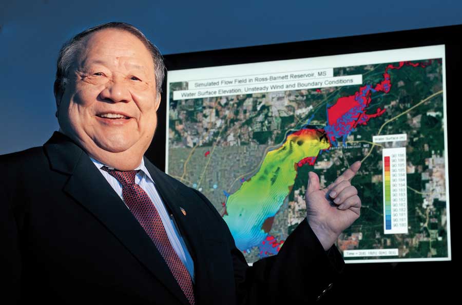
“When there is a dam break or a levee breach, the water inundates the terrain, causing disastrous impact,” Wang said. “Our models can predict the flood arrival time, the water depths, how long the water will stay and when it will recede. This information has been used by emergency management and Homeland Security officials.” NCCHE’s models can also be applied to improve dam and levee designs as well as flood warning systems during dam or levee failures.
“We want to do more to enhance the security of water infrastructures by modifying the design of dam and levee systems,” Wang said. “When the water reaches a critical stage, the discharge rates of reservoirs will be controlled to release water to unpopulated areas, so the damage to populated urban areas can be minimized.”
Yafei Jia, associate director for basic research at NCCHE, is the principal investigator of another Homeland Security project aimed at predicting the effect of flooding due to levee breach and developing better technologies for the closure of breached levees. The research will also assess the environmental impact of these floods by simulating what may be transported during movement and its effect on the quality of water and ecology.
Finding the Weak Spots
In addition to NCCHE’s research on dam breaks and levee breaches, researchers at the National Center for Physical Acoustics (NCPA) aim to prevent the breaks before they happen.
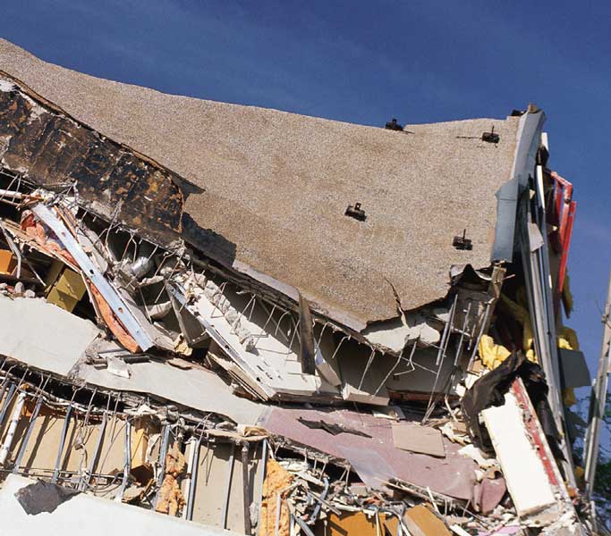
In the last 50 years, the U.S. Department of Agriculture (USDA) constructed nearly 11,000 flood-control dams in 2,000 watersheds nationwide. These watershed projects represent a $14 billion infrastructure providing flood control, municipal water supply, recreation and wildlife-habitat enhancement. But because many are aging, they also represent a perilous risk.
Often, a visual inspection of a dam is all that’s needed to identify a potential failure and repair the problem. However, others are not so easily detected. That’s where NCPA scientists come in to help.
In a project sponsored by the USDA, Drs. Jim Sabatier and Craig Hickey are using sound waves to detect invisible soft spots within the dams. The process is similar to using an ultrasound to diagnose a patient—but this time, the patient is the dam or levee. Sound waves traveling through the dam create images of its interior. These images provide unique and valuable precursory information about the onset of piping, seepage and anomalous pore pressures—all symptoms of an eventual failure.
Sabatier and Hickey’s work can help determine if internal erosion of the embankment has weakened the structures beyond repair, if repairs should commence immediately, or if the dams or levees are in fine condition. Rather than responding to a disaster, NCPA research can prevent dam and levee breaks before they occur.
Actively Listening
NCPA’s technology also fuels a worldwide project that can be used to speed the response to a volcanic eruption or more accurately predict the path of a hurricane.
NCPA’s former director, the late Dr. Hank Bass, helped establish a global system of 60 infrasonic listening stations to monitor compliance with the nuclear test ban several years ago. The extra-sensitive stations pick up low-frequency waves called infrasound and can detect explosions around the globe—even underground or in bad weather.
But the stations—which are as close by as UM’s Field Station and as far away as Antarctica and Palau—found many new uses, from helping determine what happened to the Columbia space shuttle to detecting volcanic eruptions and hurricanes.
“Hurricanes produce infrasonic traces that the air can’t absorb, and can be picked up by our devices hundreds of miles away,” said Claus Hetzer, the NCPA scientist gathering data on hurricane infrasounds. “By comparing changes in the infrasound with changes in the storm’s path and intensity, we hope to use our data to provide better forecasting in the future.”
That means more efficient evacuation, better logistical pre-planning by emergency responders and, most importantly of all, saved lives.
Staying Solid
Remember this for Trivial Pursuit: the biggest American earthquake we know of occurred in Alaska in 1964. But the most powerful earthquake in the continental U.S. did not happen in San Francisco. Or even California.
In fact, it wasn’t out west at all. In 1811, a magnitude eight quake in New Madrid, Missouri, rang church bells in Boston and damaged buildings in Charleston, South Carolina. Historical accounts say the Mississippi River ran backward. The New Madrid seismic zone is still one of the nation’s most active, according to the U.S. Geological Survey. The zone touches northern Mississippi, but building codes do not require any special considerations for earthquakes, and most communities are not prepared to deal with the damage another “big one” would cause.
That’s why civil engineering professor Dr. Chris Mullen and his colleagues at the Center for Community Earthquake Preparedness (CCEP) have spent nearly a decade educating state emergency-management officials about earthquake risks and helping responders plan for the inevitable.
Mullen developed a computational model that can literally show what will happen to key buildings or infrastructure in earthquakes of varying intensity. The model animates buildings and bridges, showing them jump, twist and sometimes fail from the strain of the shaking. Based partly on his model’s demonstration, retrofitting of several key UM campus buildings has incorporated earthquake-resistant elements, including the recent structural renovation of the 150-year-old Lyceum and the installation of seismic gas shut-off valves at high-occupancy dormitories.
Beyond campus, the simulations attracted the Mississippi Emergency Management Agency (MEMA) and the Federal Emergency Management Agency (FEMA).
“The models were also useful to plan for other disasters common here, such as hurricanes or tornadoes,” Mullen said. Based on his initial work with the earthquake model, FEMA and MEMA worked with Mullen and CCEP on an ambitious project to establish a comprehensive hazard-assessment methodology for the state.
“Using geospatial data, we can identify the affected area and estimate the local intensity of hazards within that area, inventory key infrastructure such as buildings, bridges, utility networks, roads, etc., and quantify their fragility,” Mullen said. “Our study was significant, but it was only one of several statewide and regional studies sponsored by FEMA nationally.”
That work has been followed by yet another mitigation project for Mullen through the Department of Homeland Security Science and Technology Directorate, this one using his model to predict damages to buildings in an explosion. But that’s another story.